The Southeast Alaska land trust maps juneau’s tidelands
Developing habitat maps and functional assessments of over 5,000 wetland acres
Purpose
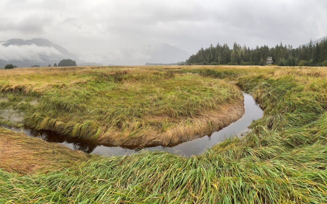
Juneau will soon have a new map for the well-loved tidelands at its heart. The Southeast Alaska Land Trust (SEALT) is updating the 1979 maps created for the Mendenhall Wetlands State Game Refuge and used in its 1990 Management Plan. This project will offer a new and timely understanding of habitat types, vegetation communities, and how post-glacial uplift has affected the resources of the Refuge and the broader wetlands complex. The 5,252-acre project area consists of the Refuge and nearby tidal and recently uplifted areas, including 22 properties that SEALT owns and stewards around the wetlands complex.
Partners & Opportunities
Project Team
SEALT engaged an independent team of wetlands specialists through Bosworth Botanical Consulting to create a digital habitat map of the project areas and assess the wetlands, salt marshes, and tidelands. These assessments score the function and importance of the area for wildlife, plants, and people.
Alaska Department of Fish & Game
The goal of this landmark project is to support the Land Trust’s work across Taashuyee-Chookan.aani, as well as the Alaska Department of Fish & Game’s stewardship of the Refuge.
Decision Tool
SEALT designed this project to provide meaningful and contextual data on which SEALT, ADF&G, and other partners can base decisions. The scale of the project will provide information for future conservation efforts as well as responsible development.
Assessment Areas

Anne Sutton, SEALT Board President, says, “We are so fortunate to have this beautiful and biologically rich expanse in the heart of our Capitol City. The Mendenhall Wetlands provide unparalleled fish and wildlife habitat and recreation for people who love hiking, hunting, birding, and simply enjoying the views. The Habitat Mapping Project improves our understanding of these wetlands and the effects of environmental change and continued development pressures. This information will be essential to the proper management of the area well into the future.”
Project Scope
External Datasets & Imagery | Assemble cartographic resources.
Field Work | Conduct surveys of vegetation, substrate, hydrology, and signs of animal and human use. Perform field work for the Wetland Ecosystem Protocol for Alaska – Southeast (WESPAK-SE) and Nearshore Assessment Tool for Alaska – Southeast (NATAK-SE).
Habitat Map | Create GIS habitat map of the 5,252 acre project area, with the classifications that align with and expand on the original 1979 habitat map.
Wetland Inventory | Assess the functions and values of the entire Refuge and nearby areas, including 18 salt marsh section and 37 shoreline segments.
“Working with the Bosworth team, and with the land trust staff and volunteers, is a joy. Between our combined centuries of field experience, over 50 drone flights, more than 4,000 ground photos, LiDAR and aerial base layers, and months of post-field tracing and cross-referencing, how could this not be the coolest map I’ve ever made?”
Richard Carstensen, cartographer and naturalist
“The best thing about this project was just being out on the Refuge, in the best and worst weather, early morning and evenings – on the parts I know well and the corners I rarely see. It has been great to see a higher level of mapping and functional assessment for the Refuge take shape, giving us new ways to know this amazing place.”
Koren Bosworth, project team leader and wetlands scientist
Partners
SEALT would like to recognize the Alaska Department of Fish & Game, Bosworth Botanical Consulting, Adamus Resource Assessment, and Territorial Sportsmen, Inc. for supporting this expansive project which will advance research, planning, and habitat management efforts for years to come.
Questions?
Please contact SEALT for follow-ups and updates on this project.
UPDATE (April 12, 2024)
All of the project assessments are now complete, and we have a near-final version of the habitat map. Check out a version of the map here!
SEALT has shared these deliverables with our key partners and we are actively using data from this project to provide informed comments to the PEL Study on the Juneau Douglas North Crossing.
Find more information about this and the Mendenhall Wetlands here.