2024 | Richard Carstensen
Well- and poorly known portals onto Taashuyee-Chookan.aani
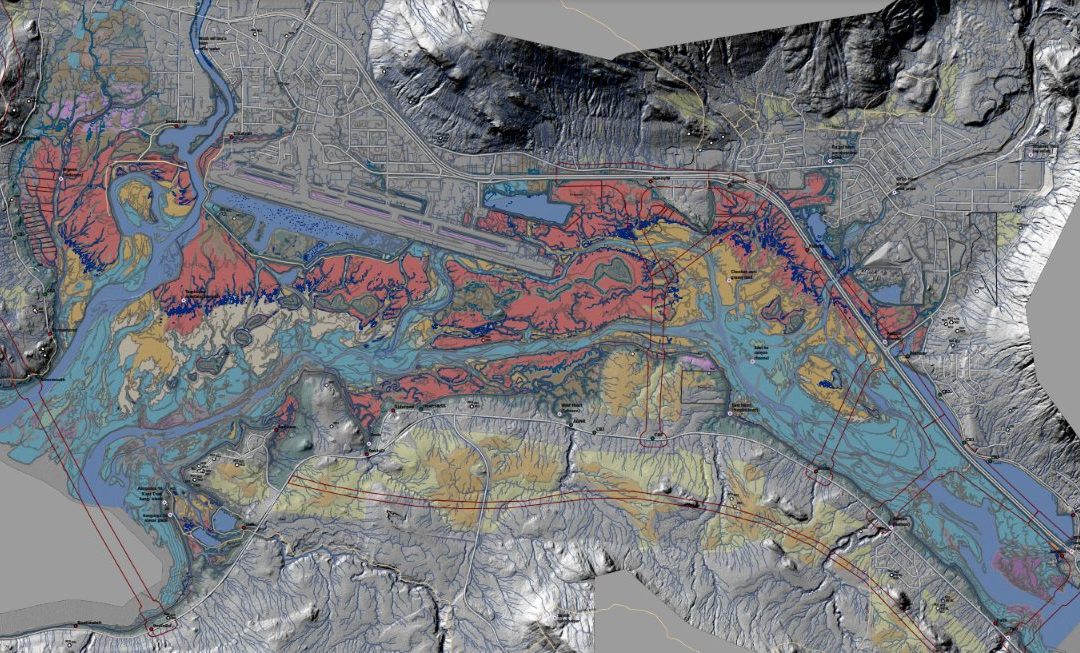
Alaska Dept of Fish & Game publishes a map of official public access points to our front-yard tidal (M-word) wetlands. At each of these entries there are metal or wooden signs (some starting to show their age), and typically parking pullouts for at least a few vehicles. As spring, 2024 unfolds, many of us are returning to the flats, eager to greet northbound waterfowl and shorebirds. This year, it would be wonderful if more of us sought out the rarely-birded corners where eBird pointcounts and nominated hotspots are sparse. Sections such as the Sayéik (Douglas Island) side, from 5-mile out to Bayview see relatively little visitation, so we don’t know nearly enough about wildlife abundance or phenology there. With that in mind I’ve created a geopdf with not only the formal ADFG access points (red dots), but also many legal access corridors (green dots) through State or Borough right-of-way parcels. Some involve a short bushwack, and you may have to park some distance away. For recent wetland surveys we often staged vehicles at official trailheads, then looped around the flats, exiting through the unmarked right-of-ways, then walking back along the road. My access points are accurate to within a few meters, and center on those public parcels, so if you leave the road at those points you’ll know you aren’t trespassing.

Access point legend: Red dots = Known access points with ADFG signage, Green dots = Informal access points open to public (Download PDF below to view)
This map also has a draft version of my 2023 habitats for Southeast Alaska Land Trust, roads and trails, 2-foot contours, LiDAR-modeled streams, AWC fish points, eagle nests, and Lingít place names. This year, check out a part of Taashuyee-Chookan.aani, river/tideflat-grassy land, that you’ve never walked before. Dike Trail, Industrial, and Fish Creek are awesome. But there’s so much more! Download 17MB pdf here ![]()